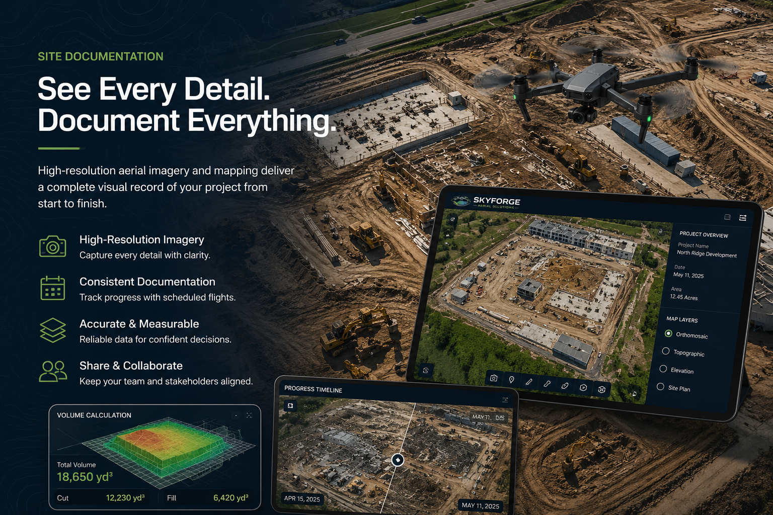
Construction Site Mapping
Create accurate aerial maps and site documentation for active construction projects.
FAA Part 107 Certified | RTK Enabled Operations
SkyForge Aerial Solutions provides professional aerial mapping, site documentation, orthomosaic imagery, and stockpile volume support for contractors, developers, engineers, and land management projects.
Overview of Services
Create accurate aerial maps and site documentation for active construction projects.
Monitor project progress with recurring aerial data collection and reporting.
High-resolution stitched aerial imagery for planning, records, and decision making.
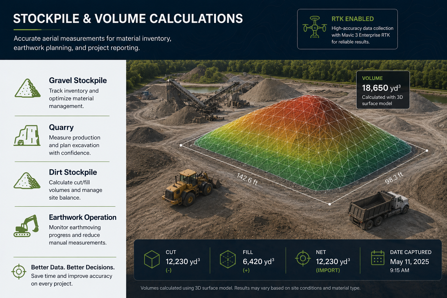
Stockpile & Volume Calculations
RTK-enabled drone data can support volume measurements for gravel, dirt, quarry, and earthwork operations. Results depend on site conditions, material type, flight planning, processing workflow, and ground control/checkpoints when used.
Why Choose SkyForge
Industries We Serve
Equipment & Technology
Professional aerial mapping platform with RTK-enabled operations, high-resolution imagery, and reliable data collection workflows for mapping and documentation projects.
Get in Touch
Michael Rockholt
Founder | FAA Part 107 Remote Pilot
Serving North Alabama and Southern Tennessee